Everything a contract manager needs, and nothing that guesses.
Verdue does one job: turn what your contractors did into evidence you can act on and hand over. Here is what that means in practice.
Six things the portal does, every day, without asking.
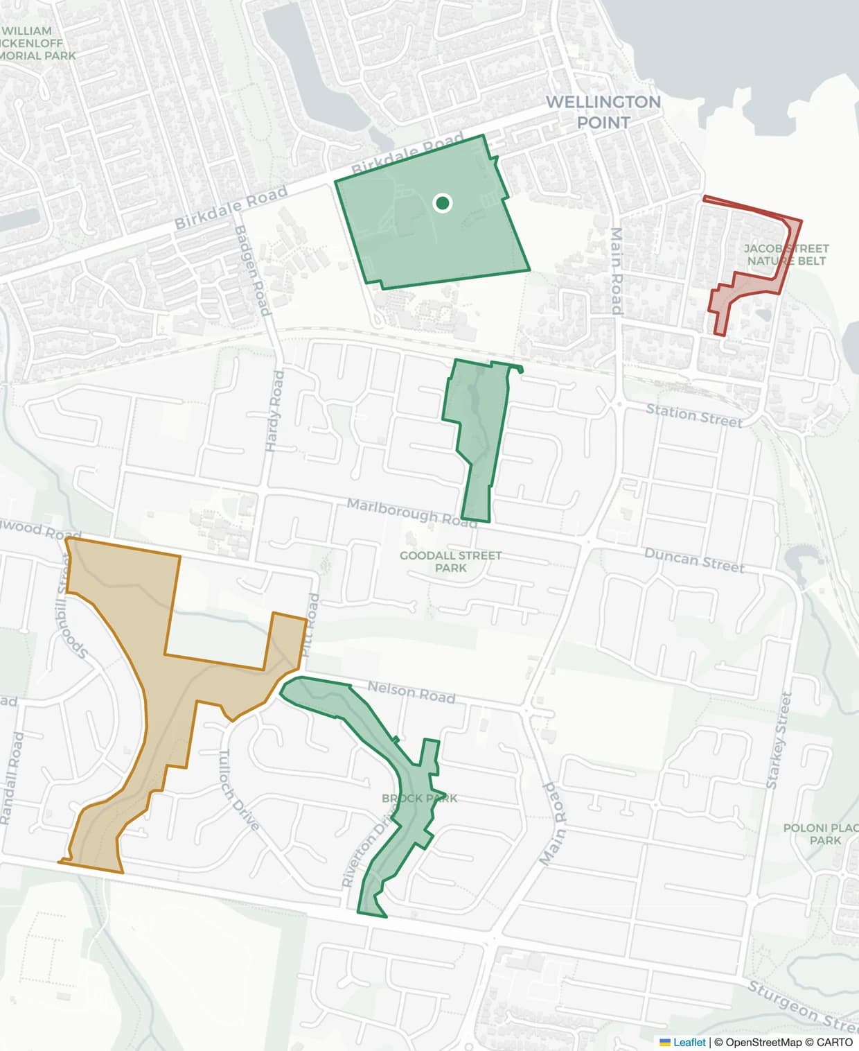
Live compliance map
Every park, reserve and corridor colour-coded by status. Filter by category, zone or contractor and see the whole LGA at once.
Boundary verification
A completion counts only when its GPS position falls inside the site polygon. PostGIS does the check, not a tickbox.
Audit-ready reporting
Monthly compliance PDFs by contractor, category and zone — generated automatically and delivered to whoever needs them.
Contractor management
Each contractor sees only their own work. You see all of it, side by side, against the schedule they signed up to.
Resident issue register
Log a complaint against the site it concerns, with severity, category and photographs, and close it against the service that resolved it.
Chemical application records
Herbicide applications arrive with product, rate, weather and operator licence attached — the EPA record, in the same place.
The whole LGA, in one view
The compliance map is the product’s home screen. Sites are shaded by status — current, due soon, overdue — so the exceptions find you rather than the other way round. It is built on PostGIS geometry, not pins on a picture, which means a road corridor is a corridor and a reserve is its actual boundary.
- Site boundaries imported from your existing GIS data
- Colour-coded by maintenance status, live
- Filter by category, zone, contractor or overdue-only
- Click through to a site’s full service history
Verified before it counts
When a contractor submits a completed service, Verdue checks the recorded position against the site polygon before the record is accepted. A job logged near the park does not turn the park green. Photographs, timestamp, operator and service type travel with the record, and none of it can be edited afterwards.
- GPS position tested against the site boundary in PostGIS
- Before and after photographs retained with the record
- Immutable once submitted — corrections are appended
- Duplicate submissions detected and discarded
- Position
- −27.4981, 153.2604 · ±4 m
- Boundary test
- Inside site polygon — verified
- Recorded
- 14 June 2026, 07:42 AEST
- Service
- Mowing — Category A parks
- Contractor
- Vantage Grounds
- Evidence
- 4 photographs · retained with record
- Record state
- Immutable · corrections appended
The document that ends the argument
Each month Verdue compiles every verified service into a single report, broken down the way your contract is written. It is generated on a schedule and delivered by email, so the monthly compliance pack stops being someone’s Friday afternoon.
- Broken down by contractor, category and zone
- Every figure shown with its denominator
- Generated automatically, delivered by email
- Exportable for insurance, audit and legal requests
Every service in this report links back to the GPS position, timestamp and photographs captured on site. Records cannot be edited after submission — corrections are appended, never overwritten.
Your contractors keep their tools. You get the evidence either way.
The council portal is one half of Verdue; the other is the app contractors use in the field. Contractors already using it are connected in minutes — and contractors using nothing at all are never shut out of your contract.
- Verdue for contractors — proof-of-service records arrive automatically over a signed webhook
- Other software — submits through the same documented interface
- No software — manual completion entry, set up during onboarding